This Monday evening forecast is brought to you by Elder Advisors Law, LLC out of Janesville, WI. (844) 211-1392. https://elderadvisorslaw.com/ https://elderadvisorslaw.com/contact/
THE FORECAST
CURRENT CONDITIONS IN WATERLOO, WI:
TIME: 445PM
TEMP: 77 Degrees
DEWPOINT: 63 Degrees
WINDS: South 6-11mph
CURRENT CONDITIONS: Sun and clouds
TONIGHT:
TEMPS: Near 60
WINDS: Light
FORECAST: A few clouds
TOMORROW:
TEMPS: Low 80s
WINDS: SW 6-11mph
FORECAST: Possible afternoon shower
Here is your full text forecast:
Good evening Southern Wisconsinites! A few clouds tonight and mild with temps near 60 degrees for overnight lows with light winds. No rain is expected.
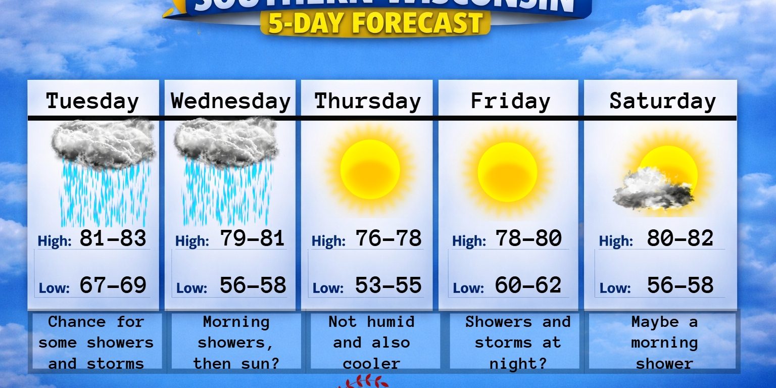
Clouds to increase tomorrow morning followed by a chance of showers in the mid afternoon hours. Temps in the low 80s with south winds 6-11mph. A little bit higher of a chance tomorrow night and maybe even a rumble of thunder. If you’re in the central Wisconsin area, you could see showers and storms in the morning. Just thought I would add that in there just in case some of them want to slide more south or if you’re camping up there. Rainfall totals will really vary around Southern Wisconsin. Some areas may get 0.05″ of rain while others get a good half inch. It all depends how the showers and storms evolve. No severe weather is anticipated at this time. Lows tomorrow night will only drop to the upper 60s with south winds 7-12mph.
Maybe some morning showers lingering around on Wednesday, but then we may see some sunshine at some point. Highs will be at or just above 80 degrees. The dewpoints will also be lowering through the day. Clearing out at night with temps in the mid to upper 50s and NW winds 4-9mph.
Sunny on Thursday and very nice with temps in the mid to possibly upper 70s. Light winds. Clear and calm at night with very comfy temps in the low to mid 50s.
Sunny and maybe a tickle or two warmer on Friday with temps at or just above 80 degrees. Some clouds and maybe some storms Friday night with temps in the low 60s.
Sunny on Saturday with just a slight chance for a morning shower. Highs will be just over 80 degrees. A couple clouds at night and some of those may spit out some light showers.
More clouds than sunshine on Sunday with temps in the mid 70s. A slight chance for a storm during the day with a better chance coming Sunday night with temps in the mid to upper 50s.
It looks to remain cooler and a bit active as we go into the week after!
Have a great night
Sam

My amazing sponsors!